- 1. Cruise to the Svalbard Islands, Norway: When to Go, Prices, and Itinerary
- 2. When to visit? The best time for a cruise to the Svalbard Islands
- 3. Climate, Average Temperatures, and Precipitation
- 4. How much does a cruise to the Svalbard Islands cost? Prices, tips, and itinerary
- 5. Cruise Itinerary
- 6. Where are the Svalbard Islands located?
- 7. What to pack?
- 8. Travel Information: Useful Tips
Cruise to the Svalbard Islands, Norway: When to Go, Prices, and Itinerary
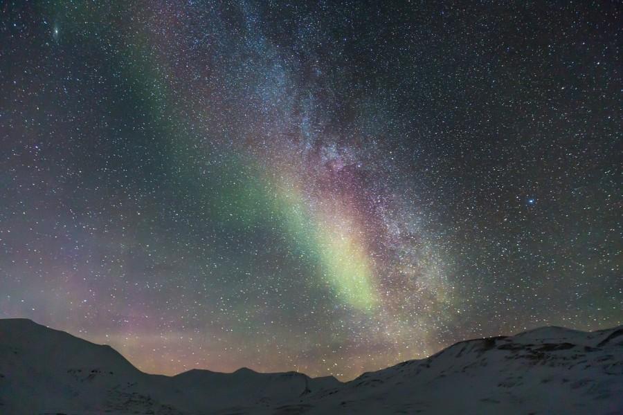
Beautiful territories where nature reigns supreme and a rich geological history that attracts thousands of geologists every year: the Svalbard Islands are all this and more. The so-called "cold coasts" (which is the translation of the name Svalbard) are a group of 5 islands (of which only 3 are inhabited) and various islets in the Arctic Ocean, in the far northern region of Norway. They are almost entirely covered in ice and are known as the Arctic Desert. A cruise to Svalbard allows you to admire magnificent landscapes, typical architecture, mountains, wildlife, and witness extraordinary phenomena, like the midnight sun (from about mid-April to late August) and the northern lights (from late October to mid-February).
When to visit? The best time for a cruise to the Svalbard Islands
- Best time: July and August are the only months when the temperature is consistently above freezing. To see Svalbard's winter aspect, the best months are April and May, as the sun is above the horizon and it's not dark all day.
- Time to avoid: There's no specific time to avoid. Winter months are icy, especially January and February, but during this time, you can witness the northern lights.
- Tips: A cruise to Svalbard requires some preparation and planning ahead, especially to manage the relatively high costs. The main danger in Svalbard is the polar bear, so remember it's prohibited to leave the safe areas without a guide carrying a weapon. The climate is harsh and unpredictable and may catch you off guard. Therefore, ensure you are physically prepared and knowledgeable about the place you're visiting. To avoid disappointment, book excursions well in advance due to high demand while keeping in mind that natural events may result in schedule changes.
Climate, Average Temperatures, and Precipitation

The climate in the Svalbard Islands is sub-polar along the western coast and polar on the eastern coasts, where temperatures remain around freezing even in summer. The weather is unstable and windy nearly all year due to the collision of air masses from different origins, although it calms slightly between June and August.
Temperatures are frigid and can reach extreme levels: the long winter (October to May) averages at -17°C, while summer (June to mid-September) is slightly above freezing. Only in July and August does it reach around 5-6°C.
As it is located beyond the Arctic Circle, the sun never sets in Svalbard from April 20 to August 25 and never rises from late October to mid-February. The long polar night can be illuminated by the enchanting northern lights. Precipitation is not abundant but frequent, occurring as sleet. In summer, there are normal rains or drizzles, especially in the plains. Sunshine is never great: it is decent in April and May but gradually decreases afterward. Still, there is a chance to see the sun for a few hours, even at midnight. Finally, the sea remains very cold throughout the year with an average of 2-3°C.
How much does a cruise to the Svalbard Islands cost? Prices, tips, and itinerary
- Price: from a minimum of €4,000 to a maximum of €8,000 per person, including intercontinental transfers, full board, a cabin, and optional excursions.
- Recommended duration: at least 13 days, ideally 15.
- Companies organizing Svalbard cruises: MSC, Hurtigruten, Holland America, Princess Cruises, Ponant.
Cruise Itinerary
There are various types of itineraries, usually depending on the company and duration. The one below is just one of many possible itineraries for cruises to the Svalbard Islands.
- Departure from New York's JFK Airport with an expected arrival at Hamburg Airport in 7 hours.
- Accommodation on the cruise and departure from Hamburg port. Navigation.
- Navigation.
- Stop at Molde for 7 hours. You can admire the stunning vegetation surrounding the area and its famous rose gardens, as well as various monuments.
- Navigation.
- Stop at Tromso for 8 hours. It is the largest and most dynamic port in northern Norway, a city full of history and culture. You can see typical Norwegian architecture, the Polaria Aquarium, and the Arctic Cathedral. From here, you can also admire the northern lights.
- Navigation.
- Stop at Spitsbergen (Svalbard Islands) for 14 hours. This is an opportunity to observe seals, walruses, whales, and seagulls. You'll be in close contact with nature and can take spectacular photographs.
- Navigation.
- Stop at Honningsvag for two days. In addition to exploring its charming center and port, there's a chance to witness the northern lights or enjoy an entire day of sunlight.
- Stay in Honningsvag.
- Navigation.
- Stop at Hellesylt for 10 hours, in northwestern Norway. The city is famous for the blue Geirangerfjord, a UNESCO World Heritage Site, where you can take a tour. Additionally, enjoy relaxing spots such as the Hellesylt Waterfall. A bus tour will let you discover Hornindal Lake, the deepest in Europe, and the villages of Nordfjord or Stryn. The Briksdal Glacier and Dalsnibba Mountain are other natural attractions not to be missed during your stop.
- Stop at Stavanger for 9 hours. Located in northwestern Norway, Stavanger is where you can explore one of its most beautiful counties, Rogaland. Learn about Viking history by wandering through the picturesque streets of the old town, exploring its medieval cathedral, and other historic structures. There's also the Norwegian Petroleum Museum, and you can go on an excursion around Lysefjord.
- Navigation.
- Return to Hamburg port, then flights back home can be organized.
Where are the Svalbard Islands located?
The Svalbard Islands are an archipelago in the Arctic Ocean, and they are the northernmost part of Norway. Their latitude ranges between 74° and 81° North, covering an area of 62,050 sq km. The largest islands are Spitsbergen, Nordaustlandet, and Edgeøya.
What to pack?
Of course, being a frozen destination, pack technical mountain clothing: fleece sweaters, heavy pants, warm and non-slip shoes. Ideally, bring windproof jackets tested for polar temperatures, scarves, gloves, and eyewear to protect against the icy wind. It's important to cover your face and head well to prevent frostbite. Even in summer, you cannot wear lightweight clothing, but pack some for navigation hours and elegant evenings, often organized on the ship. Don't forget a backpack and trekking shoes for excursions.
Travel Information: Useful Tips
- Population: 2,500
- Capital: Longyearbyen
- Area: 61,022 sq km
- Languages: Official language is Norwegian. In some areas, Russian is also spoken.
- Local currency: Norwegian Krone NOK (€1.00=9.67 NOK)
- Climate: The climate is sub-polar. Winter (October to May) has an average temperature of -17°C, while summer (June to mid-September) is slightly above freezing. Only in July and August is it around 5-6°C.
- Vaccinations: No vaccinations required.
- Entry requirements: Passport or ID valid for travel abroad.
- Distance from the United States: Approximately 3,638 miles (flight duration 7-10 hours).